After selecting a polygon, measurements of the 3D coordinates of the points are made as following. A point is selected by moving the cursor near it. The user may then enter various keyboard commands to execute certain actions.
L - compute and store the X and Y coordinates of the point, given that it is on the reference plane.
X - store the X value of the selected point
C - "paste" the stored X value into that of the selected point
Y - store the Y value
U - paste the Y value
H - store the Z (height) value
J - paste the height value
B - set the point as a base (b0) for computing height
T - set the point as a top (t0) for computing height
To measure the X and Y values of a point that is not on the reference plane, those coordinates must be measured on a point that would be directly below it in 3D, on that plane. This is not the most efficient solution, but I did not have enough time to implement a cleaner one. The height of a point above is calculated by clicking a point below it on the base plane and hitting B, selecting the point itself and hitting T, then using "Calculate Height" on the Tool menu. The height is stored, and can be pasted in using J.
After computing coordinates, the texture map of a polygon may be computed by selecting it and hitting P to store a pointer to it. Then "Calculate Texture Map" can be used on the Tool menu. This creates a file called "output.tga." This must be converted to the name of the polygon appended with .gif for use in the VRML file.
My Artifact
I started with a portrait by Domenichino from A World History of Art by Pischel, page 469.
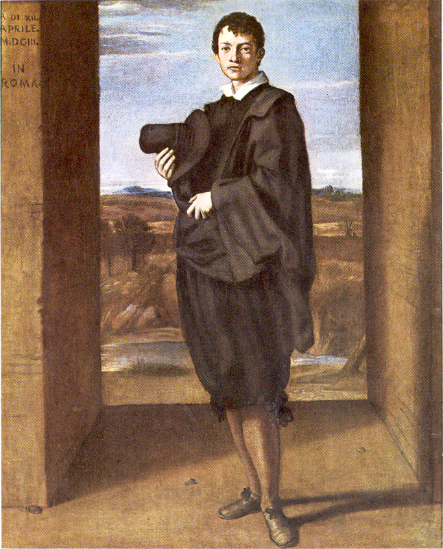
I selected roughly eleven polygons on the image to model. You can see the user interface and 3D model during creation below. The textures are obviously not in place yet, so the floor, the man, and the sky look quite odd.


I had to modify some of the texture maps in order to get the desired image. The two trees and man required cut outs using Intelligent Scissors, while the sky, lake, and two floor textures needed work in Photoshop to hide parts of the man's image. Some examples may be seen below.


Other textures may be viewed under the links.
Front floor
Right wall front
Lake
Right wall side
Left Wall Front
Left Wall Side
Tree
Tree 2
Here is a still shot from a new angle of the model:

VRML Model